♡Svalbard and Jan Mayen (Norway) ,Barentsburg
○ [pt op tr] 아름다운 풍경사진 공양, 나무불, 나무법, 나무승 With the image 'Google Earth & Map data: Google, DigitalGlobe'
●Site 방문일자 불기 2562_0929_155332
[위치정보]
Svalbard and Jan Mayen (Norway) ,Barentsburg
Barentsburg
스발바르 얀마옌 제도
78.064662, 14.232182
▶▶▶ [참조링크1]www.google.nl
-------
스발바르 얀마옌 제도(Svalbard와 Jan Mayen)는 북극해에 있는 노르웨이 영토인 스발바르 제도와 얀마옌 섬을 묶어서 부르는 이름이다. 이 지역을 위해 ISO 3166-1 부호 SJ와 SJM이 할당되어 있다. 국가 도메인으로도 ".sj"가 할당되어 있으나, 노르웨이의 ".no"를 대신 사용한다.
▶▶▶ [참조링크7]ko.wikipedia.org
▶▶▶ [참조링크7]ko.wikipedia.org
Jan Mayen 은 북극해에 위치한 노르웨이 화산섬 입니다 . 그것은 부분적으로 빙하 ( Beerenberg 화산 주위 114.2km 2 (44.1 스퀘어 mi) 의 영역)에 의해 부분적으로 덮여 지역에서 55km (34 마일) 길이 (남서 - 북동)과 373km 2 (144 sq mi)입니다 . [ 논란의 여지가있는 - 논의 ] 두 개의 부분으로 나뉘는데 북동쪽 북부 지방과 작은 소르 얀 (Sør-Jan)은 2.5km (1.6 마일)의 협곡 으로 연결되어있다 .
▶▶▶ [참조링크7]en.wikipedia.org
섬에 사는 유일한 주민은 노르웨이 군대와 노르웨이 기상 연구소 에서 근무하는 인사 입니다. 18 명이이 섬에서 겨울을 보낸다. 그러나 인구 는 무거운 유지 보수가 수행되는 여름 동안 약 2 배 (35)가 될 수있다. 인력은 6 개월 또는 1 년 중 어느 한 분이 봉사하며 4 월과 10 월에 연 2 회 교환됩니다. 역학자, 요리사, 간호사 등 지원 요원은 군인들 사이에 있습니다. 군사 요원 은 2015 년 말에 폐쇄 될 때까지 Loran-C 기지를 운영했다
▶▶▶ [참조링크7]en.wikipedia.org
▶▶▶ [참조링크8]en.wikipedia.org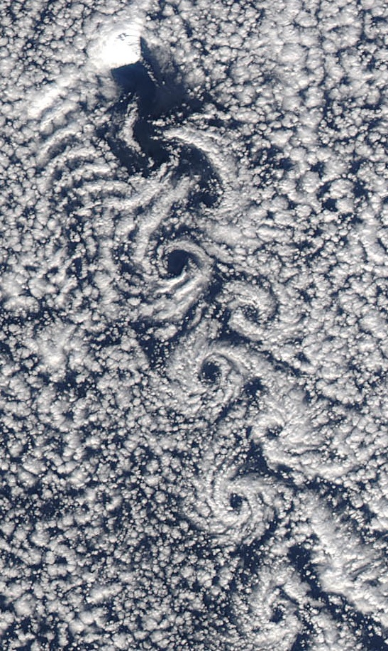
English: (Cropped) Theodore von Kármán, a Hungarian-American physicist, is well-known within NASA for helping found the Jet Propulsion Laboratory, but in atmospheric science circles he is most celebrated for his research on fluid turbulence and his pioneering work on a phenomenon known today as von Kármán vortices. Von Kármán vortices, which can appear as long linear chains of spiral eddies, form nearly anywhere that fluid flow is disturbed by an object. The atmosphere behaves like a fluid, so the wing of an airplane, a bridge, and even an island can cause the vortices to form. In the image above, an isolated Norwegian territory in the North Atlantic Ocean, called Jan Mayen Island, is responsible for the spiraling cloud pattern. The unique flow occurs when winds rushing from the north encounter Beerenberg Volcano, a snow-covered peak on the eastern end of the island that rises 2.2 kilometers (1.4 miles) above the sea surface. As winds pass around the volcano, the disturbance in the flow propagates downstream in the form of a double row of vortices that alternate their direction of rotation. Date 5 April 2012 Source http://earthobservatory.nasa.gov/NaturalHazards/view.php?id=77654 Author NASA image courtesy MODIS Rapid Response Team at NASA GSFC
Permission & Licensing : Wikipedia
Beerenberg on Jan Mayen Date 21 August 2005 Source Originally from de.wikipedia; description page is (was) here first upload in de wikipedia on 12:55, 3. Okt 2005 by Tonreg15 (2560 x 1920 (1.055.033 Byte) (Beerenberg auf Jan Mayen Eigenfoto Gernot Hecker 21.08.2005) Author Gernot Hecker
Permission & Licensing : Wikipedia
English: Egg-oeja, a peninsula on the coast of Jan Mayen (Norwegian volcanic island in the Arctic Ocean); consists of layers of volcanic ash. The beach is covered with driftwood from Siberia. Русский: Эгг-эйя (?), полуостров на береге острова Ян-Майен; берег покрыт слоем вулканического пепла. На берегу лежат брёвна (плавник), принесённые морем из Сибири. Українська: Еґґ-ейя, півострів на узбережжі острова Ян-Маєн; складається зі шарів вулканічного попелу. Берег вкритий дерев'янними колодами зі Сибіру. Date 31 August 2007 Source Own work Author Hannes Grobe, Alfred Wegener Institute
Permission & Licensing : Wikipedia
English: Old cross on the grave of seven brave dutchmen Deutsch: Altes Grabkreuz für sieben tapfere Holländer Date 1 August 2011 Source Foto stammt vom Eigentümer und Rechteinhaber des Bildes (Fotografen) und wurde frei gegeben - Buonasera Author Buonasera
Permission & Licensing : Wikipedia
English: Northwest coast of Jan Mayen island on a clear day, showing Nord-Jan and Beerenberg to the left and Sør-Jan to the right. Taken from the m/s Prinsendam. Date 3 August 2006 Source Own work Author Ian Watson
Permission & Licensing : Wikipedia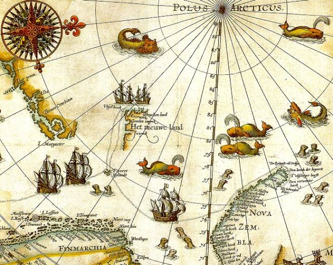
Portion of 1599 map of Arctic exploration by Willem Barentsz. Spitsbergen, here mapped for the first time, is indicated as "Het Nieuwe Land" (Dutch for "the New Land"), center-left. Date Original map 1599. Portion published online by Tromsø University 1999 as part of the "Northern Lights Route" project of the Council of Europe. Uploaded to Commons 2006. Source University Library of Tromsø Author Willem Barentsz.
Permission & Licensing : Wikipedia

Barentsburg as seen from the docks. Photo taken in August 2005 by en uskr en:user:Vfp15. Camera location 78° 03′ 50.16″ N, 14° 12′ 05.65″ E
Permission & Licensing : Wikipedia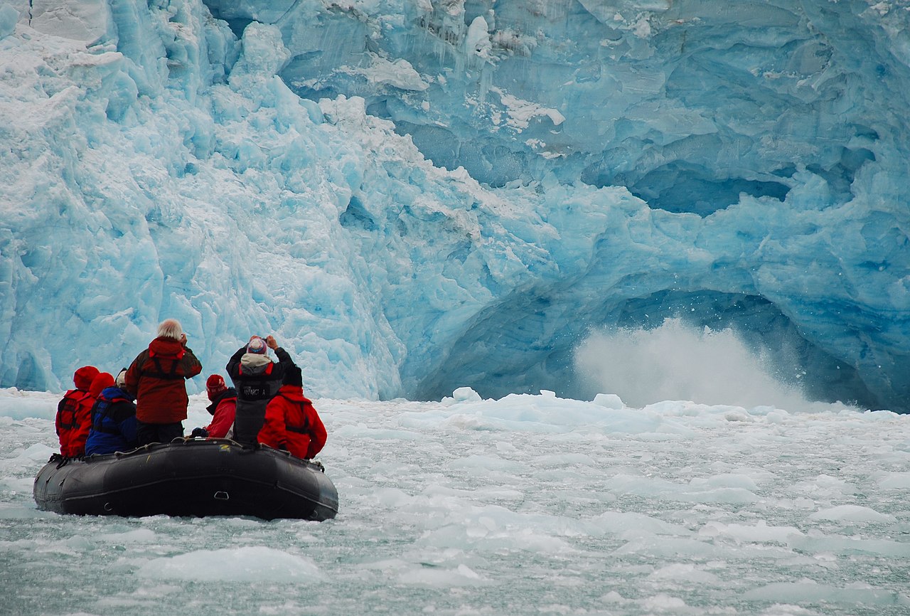
English: Ecotourism in Svalbard. Français : Écotourisme à Svalbard. Date 15 August 2008 Source Own work Author Woodwalker
Permission & Licensing : Wikipedia
Longyearbyen, at 03.15 AM, April 15, 2008 Date 15 April 2008 Source Own work Author Bjoertvedt
Permission & Licensing : Wikipedia
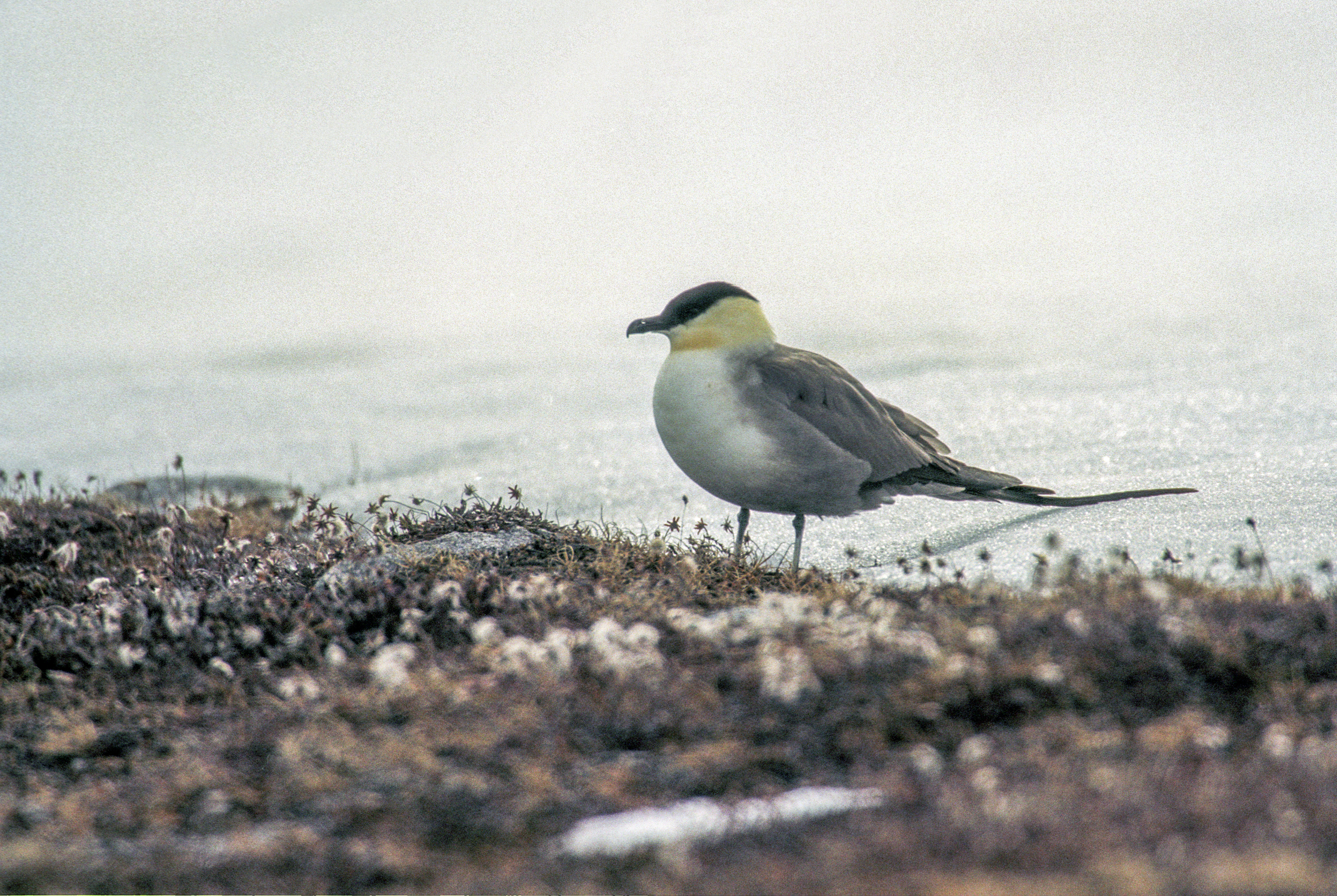
spitsbergen, Long-tailed Skua (Stercorarius longicaudus) Date 2003 Source Own work Author Jerzy Strzelecki
Permission & Licensing : Wikipedia

English: Western coast of Bünsow Land, seen from Billefjorden - inner Isfjorden in central Spitsbergen. Date 11 August 2012, 15:55:51 Source Own work Author Bjoertvedt
Permission & Licensing : Wikipedia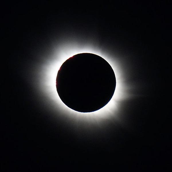
Total solar eclipse of March 20, 2015 by Damien Deltenre (licensed for free use). Date 6 February 2017, 16:50 Source Total solar eclipse of March 20, 2015 by Damien Deltenre (licensed for free use). Author Penn State
Permission & Licensing : Wikipedia
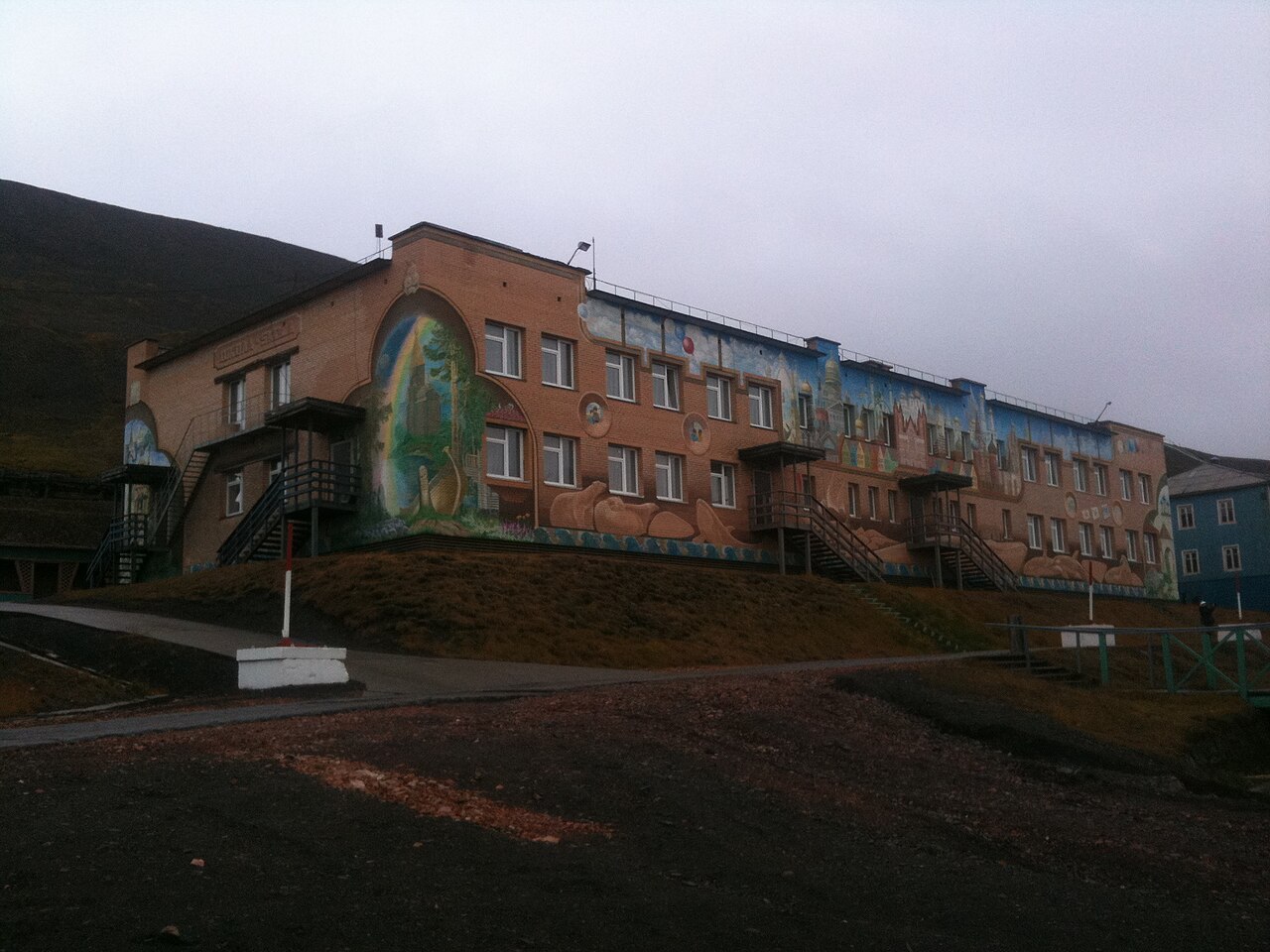
English: Barentsburg elementary school, Spitsbergen Date 11 September 2011 Source Own work Author Bjoertvedt Camera location 78° 03′ 34.8″ N, 14° 11′ 54.6″ E
Permission & Licensing : Wikipedia
UNIS Longyearbyen Norway Date 15 April 2008 Source Own work Author Bjoertvedt
Permission & Licensing : Wikipedia
With the image 'Google Earth & Map data: Google, DigitalGlobe'
▶▶▶ [참조링크11]www.google.nl
With the image 'Google Earth & Map data: Google, DigitalGlobe'
▶▶▶ [참조링크11]www.google.nl
● [pt op tr] fr