♥Estado de Nayarit,
○ [pt op tr] 아름다운 풍경사진 공양, 나무불, 나무법, 나무승 With the image 'Google Earth & Map data: Google, DigitalGlobe'
●Site 방문일자 불기 2562_0821_180108
[위치정보]
Cuenca Alimentadora del Distrito de Riego 043 Estado de Nayarit, $ en lo respectivo a las Subcuencas de los Ríos Ameca, Atenguillo, Bolaños, Grande de Santiago Juchipila, Atengo y Tlaltenango $ in Durango, Jalisco, Nayarit, Aguascalientes and Zacatecas ,Mexico
테픽
멕시코 나야리트
21.754726, -104.846491
▶▶▶ [참조링크1]www.google.nl
-------
공식적 으로 Nayarit 의 자유 및 주권 국가 ( 스페인어 : Estado Libre y Soberano de Nayarit ) 인 Nayarit ( 스페인어 발음 : [naʝaɾit] ) 는 연방 지구 와 함께 32 개 연방 기관 을 구성하는 31 개 주 중 하나입니다. 멕시코 . 그것은 20 개의 지방 자치 단체 로 나뉘며 수도는 Tepic 입니다.
북서쪽 으로 시날 로아 , 북쪽으로 두 랑고 , 북동쪽에서 사 카테 카 , 남쪽에서 할리 스코 와 경계를 이룹니다. 서쪽으로, Nayarit에는 Marías 와 Marietas 의 섬을 포함하여 태평양 에있는 해안선의 뜻 깊은 몫이 ,있다 . San Blas 의 해변과 소위 " Riviera Nayarit "은 관광객들에게 인기가 있습니다. 관광업 외에, 국가의 경제는 주로 농업과 어업에 기반을두고 있습니다.
Huichol 과 Cora 와 같은 Uto-Aztecan 원주민들의 고향 인이 지역은 16 세기 정복자 인 Hernán Cortés 와 Nuño de Guzmán 에 노출 되었습니다. 스페인어 통치는 토착 반란과 시에라 델 나야르의 열악한 지형으로 인해 어려워졌습니다. 마지막 독립 코라 지역 사회는 1722 년에 정복되었습니다.주의 이름은 Cora 사람들의 라벨을 되짚어 봅니다 . Nayearite 는 저항 지도자 Nayar를 기념합니다. [9]
▶▶▶ [참조링크7]en.wikipedia.org
English: Map of Nayarit before the Spanish conquest. Listed are the ethnic groups that inhabited the region at that time. Based on information from the historian José Ramírez Flores. Date 17 June 2013, 18:22:02 Source Own work Author AndresXXV
Permission & Licensing : Wikipedia
Español: La Contaduría Signo Calli.svg This is a photo of a monument in Mexico, identified by ID 08310 Date 29 December 2011, 11:27:19 Source Own work Author Daniel García Camera location 21° 32′ 31.09″ N, 105° 16′ 41.49″ W
Permission & Licensing : Wikipedia
English: Sayulita off the west coat of Mexico, a fishing village now much given over to tourism. Date 14 August 2007 Source Own work (S. Johnston) Transferred from en.wikipedia to Commons by User:Magnus Manske using CommonsHelper. Author S. Johnston (Sayu23 at en.wikipedia
Permission & Licensing : Wikipedia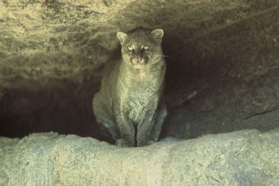
Jaguarundi; public domain image from U.S. Fish & Wildlife Service: http://www.fws.gov/southwest/es/arizona/Jaguarundi.htm
Permission & Licensing : Wikipedia
Cacti in the Cactus Gardens, at the Singapore Botanic Gardens. Date August 2006 Source Own work Author Img by Calvin teo
Permission & Licensing : Wikipedia
English: Photo of Agave tequilana t at Dona Engracia hacienda, Jalisco, Mexico Date November 2005 Source Own work Author Stan Shebs
Permission & Licensing : Wikipedia
Photo of a cane cholla flower taken in Picture taken in Elena Gallegos Picnic Area (see map), Albuquerque, New Mexico with 18-55 mm f/3.5-5.6GII ED AF-S DX Zoom-Nikkor Lens. Date 12 July 2007 Source Own work Author Skoch3
Permission & Licensing : Wikipedia
nglish: Pyramid of Quetzalcoatl, in the archeology zone of Ixtlan Español: Pirámide de Quetzalcoatl, en la zona arqueológica de Ixtlán Français : La pyramide aztèque de Quetzalcoatl, Ixtlán del Río, Nayarit, Mexique Date 10 June 2006 Source Flick.com Author Christian Frausto Bernal
Permission & Licensing : Wikipedia
Cerro de la cruz Date 15 May 2005 Source Own work Author Eduloqui
Permission & Licensing : Wikipedia
English: Shrimp fisherman on the coast of the state of Nayarit, Mexico Français : Pêcheur de crevette sur la côte de l'état de Nayarit, au Mexique. Basa Sunda: Ngecrik hurang di basisir wilayah Nayarit, Méksiko Date Source Own work Author Tomas Castelazo
Permission & Licensing : Wikipedia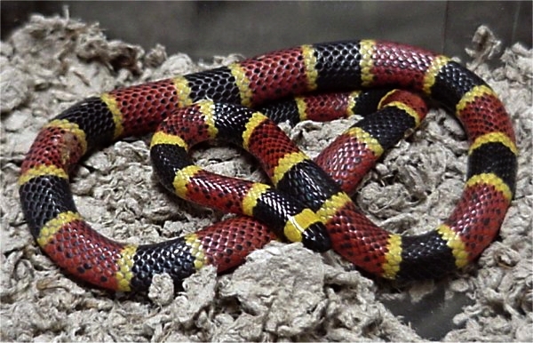
Photographer: LA Dawson Animal courtesy of Austin Reptile Service. Date 4 February 2006 (original upload date) Source Transferred from en.wikipedia to Commons. Author The original uploader was Dawson at English Wikipedia.
Permission & Licensing : Wikipedia
A Golden Eagle (Aquila chrysaetos), San Francisco Zoo Date 26 July 2007, 16:18:25 Source Flickr Author Rocky
Permission & Licensing : Wikipedia
With the image 'Google Earth & Map data: Google, DigitalGlobe'
▶▶▶ [참조링크11]www.google.nl
● [pt op tr] fr